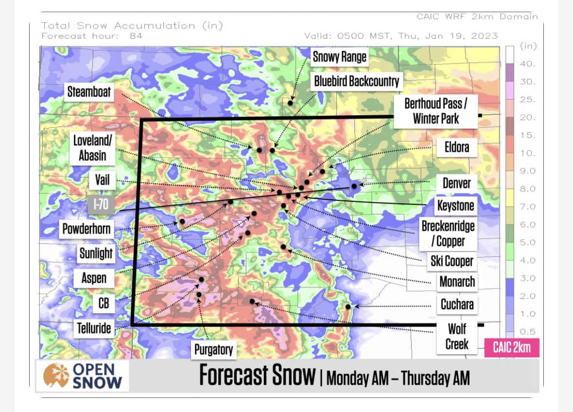
Thanks Opensnow and CAIC for the images and weather beta!!
From todays Colorado daily snow: Storm #2
The second storm of the week will bring snow to the southern mountains from Monday midday through Wednesday morning. The central and northern mountains should see the most snow from Tuesday midday/afternoon through Wednesday afternoon.
The best chance for powder in the southern mountains will be during the day on Tuesday as well as Wednesday morning’s first chair, and snow totals could be another 10-20+ inches.
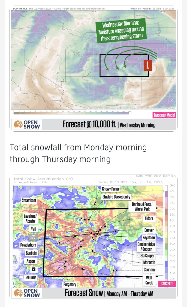
The best chance for powder in the northern and central mountains will be on Wednesday morning through midday as this is when the storm will strengthen over eastern Colorado, wrap moisture back around into our mountains, and a wind from the west and northwest will create some intense areas of snow. By Wednesday afternoon, many northern and central mountains could be close to or exceed double-digit snow totals.
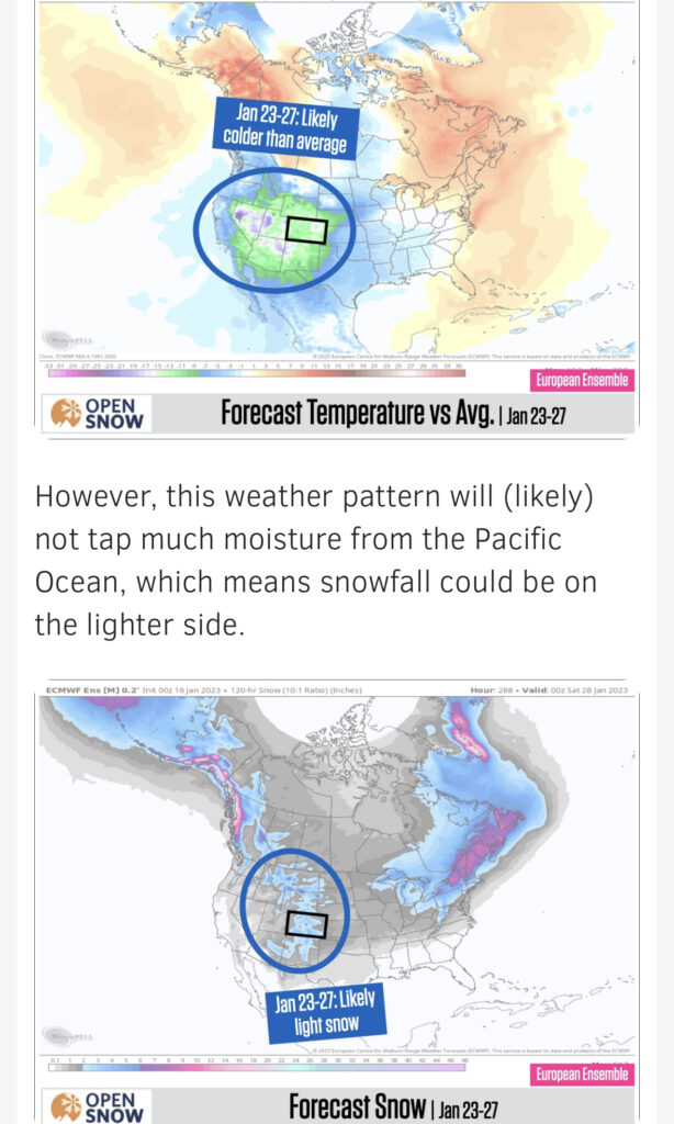
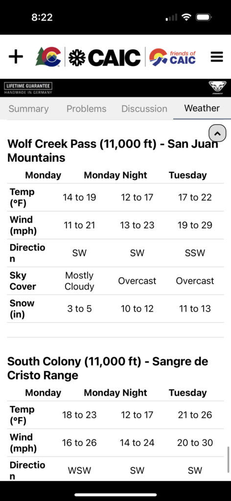
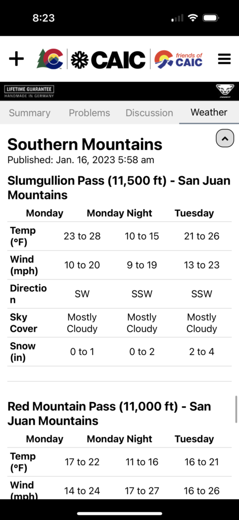
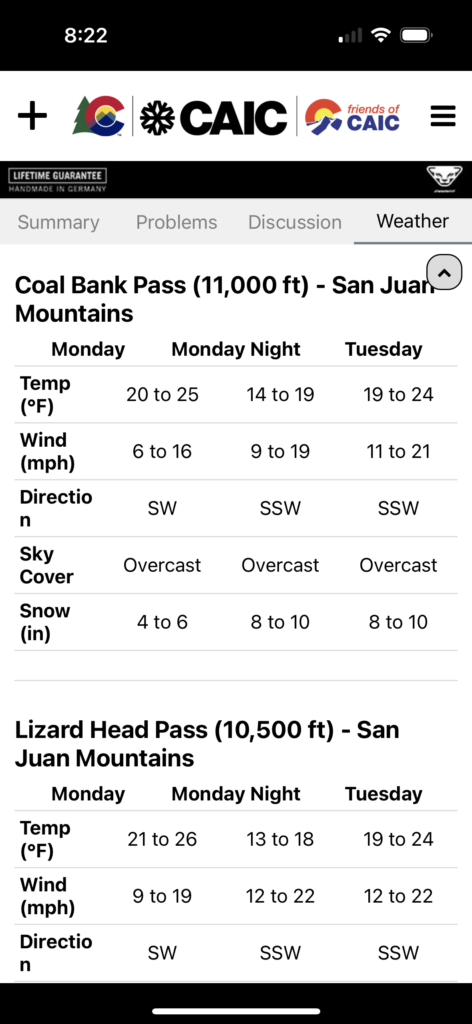
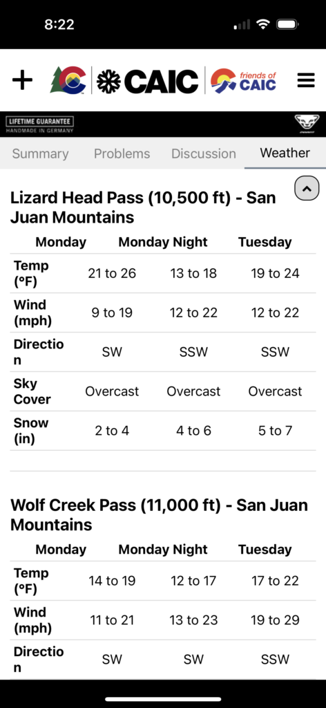
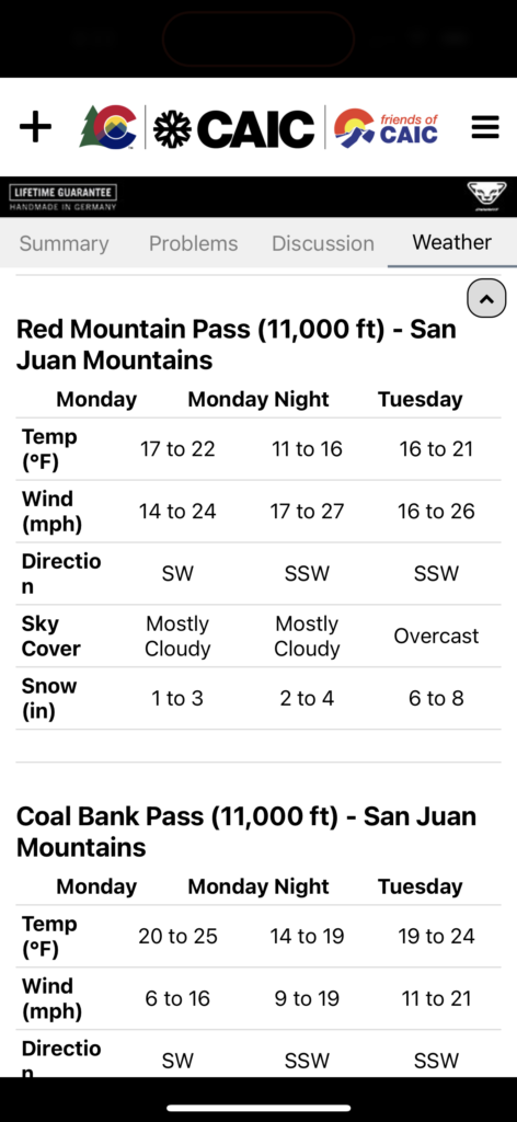
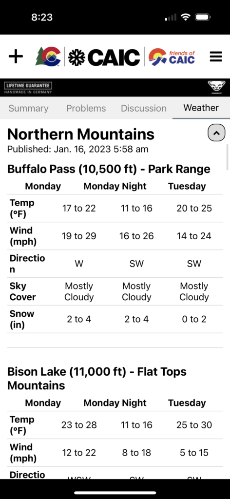
Happy we are on the right side of this system(s) as you can see the difference in snow totals from the southern part of the state to the northern differ considerably with our beloved San Juan’s getting the brunt of these storms… happy powder skiing, be safe and enjoy…

